Creating
the Northwest Territory
On the morning
of
March 1, 1781, as the Maryland delegates prepared to sign the Articles
of
Confederation and complete their ratification, Congress discussed
Western
lands. The three
New York delegates, on
that very morning, signed an “instrument” limiting and restricting the
boundaries of their state—but with stipulations attached.
Congress
would
spend much of the next eight years arguing about western land, and the
resulting creation of the Northwest Territory (1787) would rank as one
of the
most enduring accomplishments of the Confederation.
Getting the Land--Cessions from
the States
Is
Illinois a part
of Virginia, or New York? The
question
sounds ridiculous today, but at the time of independence, both states
claimed
the land which later became Illinois.
Seven states, in fact, claimed land beyond the Allegheny
Mountains which
formed the effective limit of white settlement.
The claims were based on ambiguous and conflicting British
colonial charters, and extended westward to the Mississippi River,
beyond which all parties (except for the Indians who actually lived there) agreed that the land belonged to Spanish
Louisiana. The claims are shown on the map below.
Virtually
all of the western land, in 1776, was under the firm control of
indigenous nations, reenforced by a
handful of British garrisons. But states knew, from a century of
colonial experience along the eastern seaboard, how that could change.
White people, as their numbers increased via immigration, would
eventually have enough muscle to forcibly seize native land or coerce
sale at a token price.
In the meantime, the British at least could be expelled. Virginia took its
Western claim seriously enough to send George Rogers Clark, an officer
in its
state
militia, hundreds of miles to seize British posts at Kaskaskia and
Vincennes
(now part of Illinois and Indiana respectively) during the
Revolutionary War.
Should
the Western state land claims
be honored, or should the vast domain (again, pending its eventual
seizure from American Indians) become the common property of all of the
United States? The
Articles of
Confederation, as finalized in November 1777 (see Drafting the Articles), forbade Congress from
depriving
any state of any part of its territory.
This foreclosed Congress from claiming the Western lands
for the
national government by fiat.
But,
there was
nothing to prevent the states from ceding their claims to the nation on
their
own. And, as the
1770’s wore on, the
states were more and more disposed to do so, for several reasons.
First, as settlers began trickling over the
mountains—provoking
conflicts with the local Indians every step of the way—the practical
problems
(and expense) involved with asserting such vast claims became apparent. Second, many of the states
had boundary disputes with other states in the East, where settlers already lived (see State Boundary Disputes). Abandoning
tenuous
Western claims offered good will which might redound to a state’s
benefit in
these more immediate eastern disputes.
And
third, Maryland insisted on cession as the price of confederation. The other states wanted
confederation.
The
New York
legislature led the way, authorizing its Congressional delegates
(February,
1780) to cede New York’s claims at such time, and with such
reservations, as
they might think appropriate.
This was
the instrument the delegates presented to Congress on Confederation Day. But,
the delegates added a
stipulation that
Congress must guarantee New York’s remaining boundaries, which were
under challenge from both Massachusetts and the would-be state of
Vermont.
Connecticut
followed with an offer of cession in October 1780—but only “in just
proportion”
as other states ceded their claims.
Connecticut also attached conditions as to how Congress
was to dispose
of the territory.
Finally,
in January
1781, Virginia enacted its own cession—but attached no less than eight
conditions. One of
them was that
Congress must reimburse Virginia for the expenses of Clark’s campaign. Another, most
problematical, was that
Congress must not honor any prior private land purchases or land grants within the ceded territory. Land companies,
influential in other states,
wanted their grants recognized.
There,
then,
matters stood at the moment of Confederation. New York, Connecticut, and
Virginia had ceded their Western claims, but with strings attached. Massachusetts, North and South Carolina, and Georgia stood by their claims. Congress had not yet
accepted any of the deeds
of cession.
After
long debate,
a committee report, and several postponements, Congress finally voted
to accept
the New York cession on October 29, 1782.
The vote was 7 states in favor, one opposed, two divided,
and three
unrepresented. This
may seem like a
substantial majority but was actually the minimum seven states
necessary to
approve any action under the Articles. Congress failed to
guarantee New York's remaining boundaries, but New York chose not to
protest.
The
Virginia
cession occasioned even longer debate.
At long last, in September 1783, Congress agreed to most
of the Virginia
conditions (including reimbursement for Clark), but balked at voiding
the land
company grants, and refused to guarantee Virginia’s remaining territory. Virginia accepted this
compromise in October
1783, and Congress accepted the revised Virginia cession on March 1,
1784. Seven states
voted in favor with one opposed
and one divided—again, the minimum required for passage.
This
cleared the
Northwest sufficiently for Congress to begin working on ordinances to
govern
the territory (see next section), although the claims of Massachusetts
and Connecticut still had to be settled.
Massachusetts offered an unconditional cession in November
1784, which
Congress accepted in April 1785.
Connecticut
finally
passed a new act of cession in May 1786, but attached the stiffest
condition
of all—it retained sovereignty over, and ownership of, a “western
reserve” in
what is now northeastern Ohio. The
reserve was a wedge of land 120 miles wide, between the 41st
parallel and Lake Erie. Despite
this
rider, Congress accepted the cession without a recorded vote on
September 14,
1786. Congress
blithely ignored the
Western Reserve in creating the Northwest Territory, which included it. Connecticut sold the land,
causing jurisdictional
confusion not settled until 1802, long after the Articles had given way
to the Constitution of the United States (COTUS).
The
lands south of the Ohio River don't bear directly on the creation of
the Northwest Territory, but their status during the Confedeeration
period may be noted here for completeness. Events in the south
and southwest moved more slowly. North
Carolina
and Georgia had claims contiguous to their eastern population centers, which they
might more
realistically hope to exploit. (South
Carolina, for a time, also claimed a narrow strip of western land, but
its
claim was based on mistaken notions about its western boundary, and
vanished
into the ether when South Carolina and Georgia settled their
boundary dispute
in 1787.) To make matters more complicated, Spain claimed
much
of the southern Mississippi Valley as part of Spanish Florida
(see The Treaty
That Wasn't).
North
Carolina
refused to cede its claim until May 1784, after it had already sold a
substantial
amount of the land at issue. Six
months
later, before Congress could even consider the cession, North Carolina
revoked
it. The settlers in
western North
Carolina then took matters into their own hands, organizing a new state
of
Franklin (see The
Race to Become the Fourteenth State) in what is now eastern
Tennessee.
Georgia refused to make a cession throughout the 1780’s. The western claims of
North Carolina and
Georgia would remain to be dealt with under the Constitution of 1787--as would
the claims of Spain.
Sources: Journals of the Continental Congress,
Volumes 17 through 26; Merrill Jensen, The
Articles of Confederation, 1940; Merrill Jensen, The New Nation: A History of the United
States During the Confederation, 1781-1789, 1968
Governing the Land—States or Territories?
Shall
we settle in,
on an autumn Saturday, to enjoy the football rivalry between
Cherronesus and
Metropotamia? So we
might, if Thomas
Jefferson had had his way.
Once
Congress had
gained eventual sovereignty (to be exercised after the indigenous
residents were displaced) over the land north and west of the Ohio, it
had to
decide
how to sell it, and how to govern it. As
soon as Congress heard news of the Virginia cession, the members
appointed a
committee, led by Thomas Jefferson, to prepare a recommendation. Jefferson, ever more
attuned to politics than
commerce, decided to address the issue of governance first.
The
Articles of
Confederation offered little guidance.
They did not authorize Congress to create a federal
territory, and
authorized the admittance of new states in only the most roundabout way. Article XI: “Canada
acceding to this
confederation, and joining in the measures of the United States, shall
be admitted
into and entitled to all the advantages of this union; but no other
colony
shall be admitted into the same, unless such admission be agreed to by
nine
states.” This
appeared to envision that an
external “colony” such as Bermuda might apply for admission.
Necessity,
nonetheless, is the mother of constitutional invention, and if colonies
could
be admitted as states, Jefferson was quite prepared to admit ceded land
as
states. On the very
day that Congress
accepted the Virginia cession (March 1, 1784), Jefferson’s committee
was ready
with an ordinance detailing how to do so.
Jefferson
proposed
to divide the northwest into ten future states, and not only laid out
their
boundaries, but gave them polysyllabic names laden with historic and
classical
allusion. They are
shown on the map
below.
Jefferson
would not
allow Congress to appoint territorial governments pending statehood.
That would be tyrannical.
Instead, the settlers would organize their
own local governments, as yeomen gathering at town meetings and county
conventions. When
the population of a
future state reached 20,000, the settlers would hold a constitutional convention and elect a territorial government. When the population
reached that of the
smallest of the original thirteen states (Delaware, in the 1790 census,
had a
population of 60,000), the territory would be admitted as a state.
Jefferson
was of
course a slave owner, but he recognized that slavery was incompatible
with the
society of small farmers that he wished to foster.
His ordinance banned slavery in any of the
new lands, whether state or territory, after 1800.
Not
all of
Jefferson’s proposals survived Congressional scrutiny.
Congress dropped his state names as
premature, and deleted the prohibition of slavery when only six states
supported
it. (Unsurprisingly,
all were in the
north.) Jefferson’s
ordinance was
accepted, minus these subtractions, on April 23, 1784.
It was an illusory victory.
The ordinance would be superseded before it
was implemented.
Sources: Journals of the Continental Congress,
Volume 26; Merrill Jensen, The
New
Nation: A History of the United States During the Confederation,
1781-1789,
1968
Interlude:
The Reanimation of the United
States Army
The
assertion of federal
sovereignty over the Northwest settled one matter on which Congress had
been
procrastinating—the United States would need to maintain an army.
The
United States
had had an army since June 14,
1775,
when the Continental Congress created the Continental Army. It had fought and won the
Revolutionary
War. The Articles
of Confederation formalized
the powers of Congress over the Army.
Congress was responsible for “appointing all officers in
the land forces
of the United States, excepting regimental officers”, “making rules for
the
government and regulation of the said land . . . forces”, and
“directing their
operations”. The
states, however, would
supervise the actual raising of troops, and appoint “all officers of or
under
the rank of colonel”.
Would
these provisions retain any substance after the Revolutionary War?
With
the coming of
peace (1783), the Continental Army withered.
Congress directed the army to begin “furloughing”
officers and men on May 26, 1783, pending formal discharge upon the
ratification of a final peace treaty.
At
first, the troops were reluctant to go home.
The government owed them back pay.
Grumbling soldiers mutinied in June 1783, and forced
Congress to flee
Philadelphia (see Where Was the National Capital?).
Eventually, however, the troops departed, mollified though
not satisfied
by paper vouchers for back pay which would be redeemed in the sweet bye
and
bye, when the government had money.
George
Washington resigned as Commander in Chief in December 1783. On June 2, 1784, Congress
ordered the final
demobilization, stripping the Army down to 80 men to “guard stores” at
West
Point and Fort Pitt at what is now Pittsburgh.
Had
it not been for
the Northwest, that might have been the end.
Many members of Congress felt standing (permanent)
peacetime armies were
nurseries of tyranny. Delegate
Elbridge
Gerry (MA) described standing armies as “inconsistent with the
principles of
republican Governments, dangerous to the liberties of a
free people, and
generally converted into detestable destructive engines for
establishing
despotism”. State
militias, he felt, could
provide peacetime defense.
And yet, there was
the Northwest. It
would not be part of any state, and for
some time to come, would not have a militia.
It was still under the firm control of American Indians, and they were not going to walk away of their own accord. On June 3, 1784, Congress brought a reborn Army to life,
requiring
Pennsylvania, New York, New Jersey, and Connecticut to raise 700 men
for “securing
and protecting” the Northwest. The
motion carried, nine states to two.
Even
Mr. Gerry voted in favor.
The new army would
be commanded by a lieutenant
colonel. Since this
officer would be
below the rank of colonel, he would be appointed by a state. Congress assigned the
privilege to
Pennsylvania. Pennsylvania
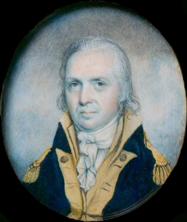
named Josiah
Harmar (above left), a Revolutionary War veteran, to the post in August
1784. Harmar
assembled his recruits
in Philadelphia, and
moved to Fort Pitt in September.
In 1785, Harmar
moved his troops into the Northwest.
Much of his work involved dispossessing Indians
and protecting treaty parleys; see From Conquest to Purchase
for the story of
Indian policy under the Articles of Confederation.
His troops also protected federal surveyors (see below),
evicted white squatters, and
constructed forts along the territorial rivers, ranging as far as what
is now
Vincennes, Indiana. In
1787 Congress
raised Harmar to the rank of Brigadier General, and increased his army
to 1,000
men.
Sources: Journals of
the Continental Congress, Volumes
24 and 27; Alan S. Brown, The Role of
the Army in Western Settlement:
Josiah Harmar’s Command,
Pennsylvania Magazine of History and Biography,
April 1969; Thomas Fleming, The Perils
of
Peace: America’s Struggle for Survival After Yorktown, 2007.
|
Selling the Land
With
governance out
of the way—for the time being--and an army in business, Congress turned
to the matter of surveying and selling the northwest.
One
issue had faded
over time—nobody any longer supported the claims of the prewar land
companies. The
national government was
deeply in debt, and the states were refusing to grant Congress the
power to tax. The
northwest was a potentially enormous
source of revenue. Congress
would sell
it, and the prewar claimants were out of luck.
If
Jefferson was
ambitious in naming new states, he was manic in his plan for
surveying
the land (May 1784). He
attempted to
change the length of the mile, extending it to 6,086.4 feet so that it
would
correspond to one minute of longitude at the Equator, or 1/21,600 of
the
circumference of the Earth. He
called
this the “geometrical mile”. “In
the
scheme for disposing of the soil,” Jefferson wrote, “an happy
opportunity
occurs for introducing into general use the geometrical mile in such a
manner
that it cannot possibly fail of forcing its way on the people . . .
This is
surely an age of innovation, and America the focus of it!”
Alas,
Jefferson
departed to serve as American ambassador to France, and was not in Congress to see his land ordinance
to
final
passage. His
colleagues lacked his
affinity for “innovation”, and watered down his ordinance to provide
for
townships of six square English miles, subdivided into 36 lots each. Once sufficient townships
had been surveyed,
they would be divvied up and assigned to the “loan offices” (so called
because
they sold government bonds) within the several states, for sale to the
public. Congress passed the land ordinance on May 20, 1785.
Thomas
Hutchins,
the Geographer (surveyor) of the United States, then assembled a crew,
and took
his chains and compass to the northwest to begin the survey. He started at the point
where the north shore
of the Ohio River intersects the western boundary of Pennsylvania, on
September
30, 1785.
Eight
days later,
he and his crew were driven off by Delaware Indians, who were
understandably
peeved at seeing white people preparing to sell their land. But Hutchins returned with
a larger crew, and
military protection (see above), in 1786, and eventually managed to
survey 35
townships. He
brought the plats to Congress in April
1787.
Congress
then decided
that the original plan of distributing sales among all 13 states was
slow and
impractical, and ordered a sale of all of the townships at public
auction in
New York to commence on September 21, 1787.
The minimum bid was $1 per acre, or $640 per square
mile.
The
sale ran from
September 21 through October 9. The
federal land office in New York failed to do a land office business. Some parcels attracted no
bids; others
attracted only one bid and went for sale at the minimum price. Nevertheless, 148 parcels
were sold for
$176,000; of which buyers paid $87,000 in cash up front. This was disappointing,
but at least it was
something.
With
surveys and
small scale sales taking time, and yielding paltry returns, land
companies
reentered the scene. If
Congress wanted
money quickly—and it did—it would have to sell land in large tracts
to
wholesalers, who would buy at a bulk discount, and sell gradually at
what they
hoped (usually correctly) would be an increasing price.
Opponents derided land companies as vultures
and speculators, and they were
often
corrupt, but they performed a valuable service in aggregating capital
and
assuming risk.
One
such outfit,
the Ohio Land Company, approached Congress in summer 1787 with an offer
that
Congress couldn’t refuse. Congress
authorized its Board of Treasury to negotiate with the Land Company,
and the
two sides signed a contract on October 21.
The OLC purchased 1.5 million acres in what is now
Southern Ohio for $1
million, with half paid up front and half to be paid later. To be sure, the OLC made
the up-front payment
in federal securities, which traded on the open market for a fraction
of their
value in specie. Nevertheless,
the sale
reduced the national debt by $500,000 at a stroke.
Rufus
Putnam, the
guiding genius behind the Ohio Land Company, led the first group of
settlers to
Ohio the following spring, and they founded the town of Marietta.
Sources:
Journals of the Continental Congress,
Volumes 26 and 28; Andro Linklater, Measuring
America: How the United States was Shaped by the Greatest Land Sale in
History,
2002; Albion Dyer, First Ownership of
Ohio Lands, 1911
Governing the Land, Part 2:
Creating the Northwest Territory
With
the northwest
about to begin filling up, with buyers from both the New York auction
and the
Ohio Land Company, Congress looked anew at governance.
Thomas Jefferson, with his notion of
self-governing yeomen, was still in France, and by 1787 Congress had
had enough
of weak government. Congress
took up the
famous Northwest Ordinance of 1787, which scrapped the Ordinance of
1784
altogether and with it Jefferson’s ten future states.
 Instead,
Congress
created the first federal territory, formally styled "the Territory of
the United States, North-West of the River Ohio", with a territorial
governor to be
appointed
by Congress itself. The
governor would
command the militia, promulgate a temporary law code, and appoint
magistrates. Congress
would also elect a territorial
court. The
citizenry would eventually be
allowed to elect a legislature, but even then Congress would appoint
the upper
house. In due time,
the territory would
form between three and five states. Instead,
Congress
created the first federal territory, formally styled "the Territory of
the United States, North-West of the River Ohio", with a territorial
governor to be
appointed
by Congress itself. The
governor would
command the militia, promulgate a temporary law code, and appoint
magistrates. Congress
would also elect a territorial
court. The
citizenry would eventually be
allowed to elect a legislature, but even then Congress would appoint
the upper
house. In due time,
the territory would
form between three and five states.
Since
settlers
might fear an appointed government, Congress appended a bill of rights
guaranteeing
freedom of religion, habeas corpus, trial by jury, and due process. Finally, Congress restored
the prohibition of
slavery, which had been deleted from the Ordinance of 1784, and even
strengthened it by making it immediate instead of waiting until 1800.
Congress
passed the
Northwest Ordinance by 8 votes to zero on July 13, 1787. Congress elected its own
outgoing President, Arthur
St. Clair, as the first territorial governor (October 5). He assumed his duties at
Marietta, Ohio on
July 9, 1788.
 The
remainder of
the story belongs to the Constitution of the United States (COTUS), but the foundation had been
laid. The COTUS
armed Congress
with explicit power
to admit new states and “make all needful Rules and Regulations” for
federal
territories. Congress
under the COTUS
repassed the Northwest Ordinance virtually unchanged in 1789. It remained as the model
for settling and
governing new territory from the Mississippi River to the Pacific. The
remainder of
the story belongs to the Constitution of the United States (COTUS), but the foundation had been
laid. The COTUS
armed Congress
with explicit power
to admit new states and “make all needful Rules and Regulations” for
federal
territories. Congress
under the COTUS
repassed the Northwest Ordinance virtually unchanged in 1789. It remained as the model
for settling and
governing new territory from the Mississippi River to the Pacific.
The
government
resumed its abandoned land survey in 1796.
Voters elected the first territorial legislature in
1798. The process
of admitting
the land making up
the Northwest Territory as states began in 1802 (Ohio) and was finally
completed in 1858, with the admission of Minnesota.
Flying
over the
Midwest today, one still sees the checkerboard grid of townships and
farms—the
legacy of the Northwest Ordinance and the Articles of Confederation.
Sources:
Journals of the Continental Congress,
Volumes 32 and 33; Andro Linklater, Measuring
America: How the United States was Shaped by the Greatest Land Sale in
History,
2002
|
Nathan Dane and the Exclusion of
Slavery

In
1835, Nathan
Dane died. Eulogists
compared him to
lawgivers of the ancient world, hailing him as “Lycurgus-like”, as a
“new
Moses”, and possessed of “a mighty intellect like the Sun of heaven”.
What
had Dane
done? He had acted
as the principal
author of the Northwest Ordinance, 48 years earlier, and especially of
the
clause banning slavery in the Northwest Territory.
Nathan
Dane was
born in Massachusetts in 1752. He
worked
as a young man as a school teacher and lawyer, and was elected to the
Massachusetts Legislature in 1782 and to the Confederation Congress in
1785.
Dane
showed up
regularly at Congress, and sought out committee work.
With Congressional attendance dwindling in 1787,
these attributes earned Dane a modicum of leadership.
When Congress needed a committee to prepare
the Northwest Ordinance in its final form, Dane was named to the
Committee and
did most of the writing.
He
didn’t say
anything, in his first draft, about slavery.
He knew that Congress had rejected a ban on slavery
in the Northwest in
1784, with not one southern state voting in favor.
But when the ordinance came before Congress
as a whole, on July 12 or 13, Dane suddenly moved to add a sixth
article
banning slavery, and Congress acquiesced without a recorded vote. The next week (July 16),
Dane wrote:
When
I drew the ordinance which
passed (in a few words excepted) as I originally formed it, I had no
idea the
States would agree to the sixth Article prohibiting Slavery--as only
Massachusetts of the Eastern States was present--and therefore omitted
it in
the draft--but finding the House favorably disposed on this subject,
after we
had completed the other parts I moved the article which was agreed to
without
opposition.
Why did the
Southern states agree to what they had rejected three years earlier? William Grayson of
Virginia wrote that the
clause “was agreed to by the Southern members for the
purpose of
preventing Tobacco & Indigo from being made on the N.W. side of
the
Ohio.” In other
words, Grayson wanted to
protect Virginia planters from competition.
(He need not have worried.
The
Midwest is too cold to grow indigo.)
Other delegates may
have been influenced by the land companies, which averred that a ban on
slavery
would be popular with potential buyers, and thus enable Congress to
sell more
land and make money faster. The
Northwest Ordinance wasn't the last word on slavery in the American
Midwest. Battles over human bondage had to be re-fought in subsequent
decades, especially in Illinois and Indiana which had legacies of
French colonial slavery and attracted early Southern settlement.
But freedom ultimately prevailed in every state created from the
Northwest Territory.
And the slavery ban grew more important over time, however
haphazardly
and opportunistically it might have been added to the Ordinance.
Over the following decades, territorial bans
emerged as the primary Northern strategy for containing slavery. As Abraham Lincoln put it,
“we think it is
wrong and ought to be restricted”.
As the North
sought to restrict slavery, white Southerners fought against such restrictions. They blew them apart
entirely in 1857, when
Chief Justice Roger Taney, a Marylander, found that Congress had no
power to
ban slavery in any territory, anywhere.
The fact that the Confederation Congress, much weaker than Congress under the COTUS,
had believed such a ban
within its competence in 1787--without any controversy and without a
single
dissenting Southern vote—was a powerful rebuttal to his views.
What
of Nathan
Dane, who started the process in train?
He returned to Massachusetts and served again in the
Legislature, but
eventually had to retire from politics because he had gone deaf. He retreated to the life
of a scholar,
writing treatises on American law which were much respected in the
Nineteenth
Century.
He
was sadly
forgotten in the years after his death.
His memory lives today, to the extent that it lives
at all, mostly via
Dane County in Wisconsin, home to the state capital and the University
of
Wisconsin.
Sources:
Letters of Delegates to Congress,
Volume
24; Peter Onuf, Statehood and Union: A
History of the Northwest Ordinance, 1987; Jay Barrett, Evolution of the Ordinance of 1787, 1891;
Jon Wakelyn, Birth of
the Bill of Rights: Biographies, 2004
|
©
2021 Clionic Enterprises | Back
to Home Page | Back
to "Accomplishments" |

